Gallery
 PM Modi visit USA
 Only the mirror in my washroom and phone gallery see the crazy me : Sara Khan
 Karnataka rain fury: Photos of flooded streets, uprooted trees
 Cannes 2022: Deepika Padukone stuns at the French Riviera in Sabyasachi outfit
 Ranbir Kapoor And Alia Bhatt's Wedding Pics - Sealed With A Kiss
 Oscars 2022: Every Academy Award Winner
 Shane Warne (1969-2022): Australian cricket legend's life in pictures
 Photos: What Russia's invasion of Ukraine looks like on the ground
 Lata Mangeshkar (1929-2022): A pictorial tribute to the 'Nightingale of India'
 PM Modi unveils 216-feet tall Statue of Equality in Hyderabad (PHOTOS)
India Open Competition in Shotgun, organised by the National Rifle Association of India (N
- Hockey India names Amir Ali-led 20-man team for Junior Asia Cup
- Harmanpreet Singh named FIH Player of the Year, PR Sreejesh gets best goalkeeper award
- World Boxing medallist Gaurav Bidhuri to flag off 'Delhi Against Drugs' movement on Nov 17
- U23 World Wrestling Championship: Chirag Chikkara wins gold as India end campaign with nine medals
- FIFA president Infantino confirms at least 9 African teams for the 2026 World Cup
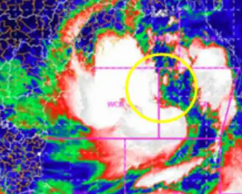
Cyclone Yaas: Storm intensifies, likely to cross Odisha-Bengal coasts on May 26 Last Updated : 24 May 2021 02:06:54 PM IST 
The deep depression over east central Bay of Bengal remained practically stationary during past six hours and has intensified into cyclonic storm 'Yaas' (pronounced as 'Yass') on Monday.
The cyclone in Bay of Bengal laid centered at 5.30 a.m. on Monday near latitude 16.3 degree north and longitude 89.7 degree east, about 600 km north-northwest of Port Blair (Andaman Islands), 540 km south-southeast of Paradip (Odisha), 650 km south-southeast of Balasore (Odisha) and 630 km south-southeast of Digha (West Bengal).It is very likely to move slowly north-northwestwards, intensify further into a Severe Cyclonic Storm during next 24 hours and into a Very Severe Cyclonic Storm during subsequent 24 hours, said National Weather Forecasting Centre of India Meteorological Department (IMD)."The cyclone would continue to move north-northwestwards, intensify further and reach Northwest Bay of Bengal near north Odisha and West Bengal coasts by May 26 early morning," the IMD said."It is very likely to cross north Odisha-West Bengal coasts between Paradip and Sagar islands around May 26 noon as a very severe cyclonic storm.""Under the influence of a Western disturbance, thunderstorm and lightning accompanied with isolated to fairly widespread rainfall is likely over Western Himalayan Region and isolated rainfall and thunderstorm over plains of Northwest India during next 24 hours. Isolated dust storm also very likely over Rajasthan during next 24 hours," said the IMD.Besides, strong surface or dust raising winds (25-35 kmph) is likely over Rajasthan, Haryana, Chandigarh and Delhi and Uttar Pradesh during next three days.Heavy to very heavy rainfall warning was made by the IMD at "isolated places over Andaman and Nicobar Islands for May 23 as well as for May 24; over north coastal Odisha on May 25; Gangetic West Bengal on May 25-27 and Jharkhand on May 26 and Bihar on May 27; scattered heavy to very heavy rainfall with isolated extremely falls over Odisha and Gangetic West Bengal on May 26 and isolated heavy to very heavy rainfall with extreme falls over Jharkhand on May 27".The fishermen are advised not to venture into southeast and east central Bay of Bengal, Andaman Sea and along and off Andaman and Nicobar Islands during May 23-24; into central Bay of Bengal from May 23-25 and into north Bay of Bengal and along and off West Bengal-Odisha-Bangladesh coasts from May 24-26. Those who are out in the deep sea of east central and adjoining northeast Bay of Bengal are advised to return to the coast.The IMD had predicted tidal wave of 1-2 meter height to inundate low lying areas of Andaman and Nicobar Islands on May 24.IANS New Delhi For Latest Updates Please-
Join us on
Follow us on


172.31.16.186


